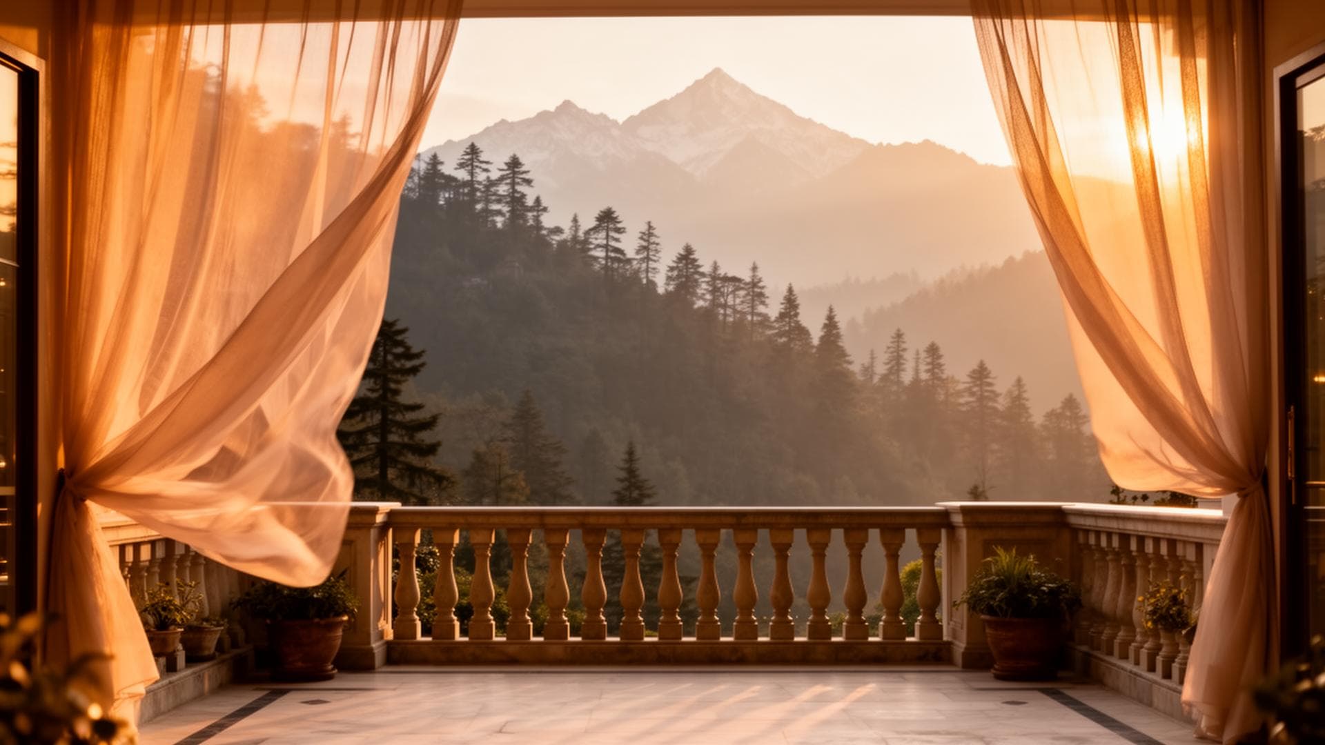
What is Mushkpuri Top weather today and what is its height?
Mushkpuri Top height: 9,230 feet (2,813 metres) — the highest accessible peak in the Galyat chain and the Murree hills region. Live weather: Google 'mushkpuri top weather' — the weather card shows current temperature and conditions. AccuWeather search 'Nathia Gali Pakistan' for the closest specific-location forecast (Mushkpuri Top is 3km above Nathia Gali — approximately 2°C cooler than Nathia Gali's 8,000ft reading). PMD (pmd.gov.pk) for official regional snowfall and weather advisories. From Himalaya Villas in Bhurban: Mushkpuri Top is 35km, 50 minutes by car to the Nathia Gali trailhead.
The Mushkpuri Weather Search Cluster
'Mushkpuri Top weather' generates 5,400 monthly searches — a significant standalone weather cluster driven by hikers and trip planners checking summit conditions before attempting the ascent. The additional sub-queries — 'mushkpuri top height' (480/mo), 'mushkpuri top distance from Islamabad' (480/mo), 'mushkpuri top location' (390/mo), 'mushkpuri top temperature' (140/mo) — add a further 1,500 monthly searches to the cluster total.

Mushkpuri Top — Essential Facts
| Detail | Information |
|---|---|
| Height | 9,230 feet (2,813 metres) above sea level |
| Location | Above Nathia Gali, Galyat chain, Abbottabad District, KPK, Pakistan |
| Province | Khyber Pakhtunkhwa (KPK) |
| Distance from Islamabad | 88km — approximately 1h 30min to Nathia Gali trailhead |
| Distance from Bhurban | 35km — approximately 50 minutes to trailhead |
| Distance from Nathia Gali | Trailhead approximately 1km above Nathia Gali main road |
| Trail length | 6km ascent from trailhead to summit (one way) |
| Elevation gain | ~1,200 feet from trailhead (8,000ft) to summit (9,230ft) |
| Hiking time | 3–4 hours ascent, 2–3 hours descent |
| Difficulty | High — sustained elevation gain, rocky upper section |
| Best season | May–October; October for clearest summit views |
| Summit character | Open grassy meadow — treeline ends below summit |
Mushkpuri Top Weather — The Temperature Reality
At 9,230 feet, Mushkpuri Top is approximately 2,400 feet above Bhurban and 1,200 feet above Nathia Gali. The temperature gradient in the Galyat hills runs approximately -0.65°C per 100 metres of ascent. This means:
Temperature Comparison by Location
| Location | Elevation | Typical July Afternoon | Typical October Morning | Typical January Day |
|---|---|---|---|---|
| Islamabad | 1,800 ft | 40–44°C | 22–27°C | 5–12°C |
| Bhurban (Himalaya Villas) | 6,800 ft | 20–24°C | 8–18°C | -2 to 8°C |
| Nathia Gali | 8,000 ft | 17–22°C | 6–17°C | -4 to 6°C |
| Mushkpuri Top Summit | 9,230 ft | 14–19°C | 4–14°C | -6 to 3°C (exposed) |
The Summit Reality — Exposed and Cold
The summit at 9,230 feet is the coldest point in the Galyat chain — exposed, wind-prone, and lacking the forest microclimate that moderates temperatures in the valley and lower ridges. On the summit in July, a hiker from Islamabad experiences a 25–30°C temperature drop from their departure city. In January, the exposed summit can reach -10°C or below with windchill.
How to Check Mushkpuri Top Weather Today
Mushkpuri Top Weather by Season — Hiking Suitability
| Month | Summit Temp | Wind | Snowfall Risk | Hiking Suitability |
|---|---|---|---|---|
| January | -8 to 2°C | Often high | Very high — deep snow likely | Not recommended without mountaineering experience |
| February | -5 to 5°C | Moderate–high | High | Experienced hikers with crampons only |
| March | 0 to 10°C | Moderate | Some lingering snow | Possible; confirm snow-free trail locally |
| April | 5 to 15°C | Moderate | Very low | Good — rhododendron on lower slopes |
| May | 10 to 18°C | Light–moderate | Zero | Excellent — daisies on upper meadow |
| June | 12 to 20°C | Light | Zero | Very good — pre-monsoon green |
| July | 14 to 20°C | Light | Zero | Good morning window — cloud by noon |
| August | 13 to 19°C | Light | Zero | Same as July — depart very early |
| September | 10 to 18°C | Light | Zero | Excellent — post-monsoon clarity |
| October | 4 to 15°C | Light–moderate | Zero | BEST — crystal views, amber forest below |
| November | 0 to 10°C | Moderate | Very low | Good — quiet, clear, cold |
| December | -3 to 7°C | Moderate–high | 25–35% | Risk of snowfall — check PMD before |
The Mushkpuri Top Hike — Complete Planning Guide
The Trailhead: The Mushkpuri Top trailhead is approximately 1km above Nathia Gali main bazaar on the upper road — ask for 'Mushkpuri trailhead' or 'Mushkpuri track' at any Nathia Gali hotel or local shop. There is no formal parking area at the trailhead — park on the roadside near the track start. A local guide can be arranged in Nathia Gali town; strongly recommended for first-time hikers.
Phase 1 (0–3km, trailhead to treeline): the trail enters the mixed Galyat forest immediately — deodar cedar, blue pine, and Himalayan oak at the lower elevations transitioning to pure oak and rhododendron as the trail ascends. The forest canopy provides shade and shelter. The trail is clear and reasonably maintained by regular hiker traffic.
Phase 2 (3–5km, treeline to upper meadow): the forest ends as the trail approaches 9,000 feet. The vegetation transitions to open sub-alpine grassland — the Mushkpuri 'daisy meadow' that covers the upper slopes in May–June. The views begin opening in all directions from approximately 8,800 feet.
Phase 3 (5–6km, upper meadow to summit): the final approach across open exposed ground. The path is clear on the upper section. In October, the summit views include the entire Galyat ridge system, the valleys of KPK below, and — on the finest days — distant Himalayan peaks to the northeast. The summit area is marked by a small stone cairn.
Mushkpuri Top from Bhurban — Day Trip Logistics
Depart Himalaya Villas 5:30am. Drive 35km to Nathia Gali (50 minutes via Ghora Gali, Changla Gali). GPS: Nathia Gali main bazaar.
Arrange guide (optional but recommended): ask at any Nathia Gali hotel or local shop. PKR 1,500–3,000 for a local guide to the summit.
Begin ascent from trailhead (1km above Nathia Gali) at 7:00am.
Summit by 10:00–11:00am (3–4 hours from trailhead). Spend 20–30 minutes at summit. Take in the views before cloud builds.
Begin descent by 11:00–11:30am. Arrive trailhead 1:30–2:00pm.
Return to Bhurban by 3:00pm. Cedar estate rest. Fire pit at 6:30pm.
Frequently Asked Questions
How far is Mushkpuri Top from Islamabad?
Mushkpuri Top is approximately 88km from Islamabad — 1h 10min drive to Nathia Gali plus the 6km ascent from the trailhead. Total journey: depart Islamabad 6am, begin hike 7:30am, summit by 11am, return to Islamabad by 4pm (long day).
Is Mushkpuri Top dangerous?
The trail is demanding but not technically dangerous for fit hikers in good weather from May–October. The risks increase significantly in snowfall (slippery trail, loss of path visibility), strong wind on the exposed summit, and in cloud (navigation difficulty on the open upper section). A local guide eliminates most navigation risk. Never attempt in active snowfall.
Can you see snow peaks from Mushkpuri Top?
On the clearest days — typically October mornings after overnight clearing, or May mornings before monsoon haze — distant snow peaks of AJK and the Hindu Kush foothills are visible to the north and northeast. This is not guaranteed; the clarity depends on atmospheric conditions on the specific day.
What is the best time to hike Mushkpuri Top?
October week 2–3 is the consensus best window: crystal atmospheric clarity after the monsoon, the amber deciduous forest below the treeline, comfortable summit temperatures (4–14°C), and zero precipitation risk. May is the second-best month for the daisy meadow bloom on the upper slopes.
Book Bhurban as Your Mushkpuri Base
WhatsApp +92 304 567 9000
Book your private villa stay at Himalaya Villas & Resorts.
Book Your StayDirect bookings receive the best available rate.